Organic Maps review
There are many navigation apps to choose from for planning hikes and navigating along the way, meet the open-source Organic Maps in this review.
Open Source software is one of the wonders of the Internet, and what makes it great. This website is built upon Open Source software and so is a large chunk of the internet. Organic Maps is the same in that way, that the source code is open for anyone to look into, improve, and add to. You can find it on GitHub if you want to contribute.
This is what sets it apart from the original Maps.me, which over the years focuses itself more on becoming a for-profit application. And hiding functionality behind paywalls and accounts. It must be said that I used Maps.me for many years without paying for anything, but since I was introduced to Organic Maps I don’t think I’m going back.
Organic Maps is a fork of the original project and lays it focus on Privacy and Open Source. No data is sent to a bazillion advertisers, and the application is free to use, both commercially and privately.
Organic Maps is available for Android, IOS, F-Droid, Huawei app gallery, and Obtainium.
Downloading offline maps
What makes Organic Maps great is that you can easily and pretty much without thought download offline maps, so that you can focus on the hike, and not be bothered by needing an internet connection or other hurdles along the way. Simply install the app, zoom into where you’re going to be hiking, and an offline map is automatically downloaded after a prompt to your phone for you to use whenever and wherever.
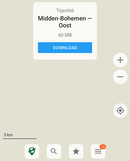
This makes it a joy to use and you can easily download a whole area where you’re going to be hiking in moments. Depending on your internet connection.
You can also easily update existing maps in case the map is a few months or years old to get all the latest information on there.
In their marketing, they also claim that you can download all that you need and throw away your SIM card from your phone. I don’t doubt that’s true, I however like to be able to contact and surf if needed.
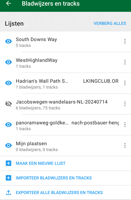
Downloading and adding tracks or routes
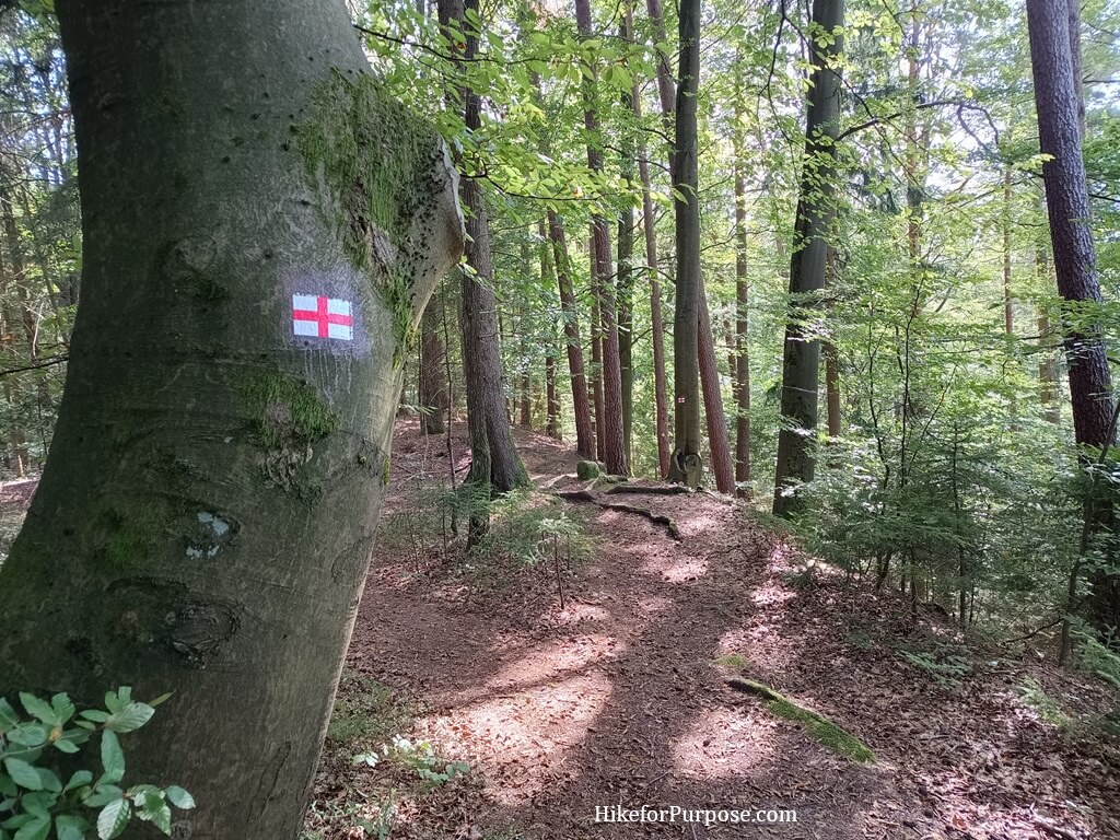
You can download any routes or tracks in KML, KMZ, KMB, or GPX format or extension, so that gives it a lot of versatility compared to other apps. You can simply visit the website of the hike that you want to do, such as the West Highland Way, and download the GPX file that’s offered. Afterwards, simply open the file with Organic Maps, and then you have it loaded up.
Sharing and importing tracks is quite easy using Organic Maps, and you can hide or show tracks depending on your preferences.
That way you don’t have your maps or overview cluttered with any irrelevant information.
For nearly every hike it is possible to find tracks and waypoints online, from the Appalachian Trail, and Camino de Santiago, to hikes around your area. Some great resources are:
https://hiking.waymarkedtrails.org/
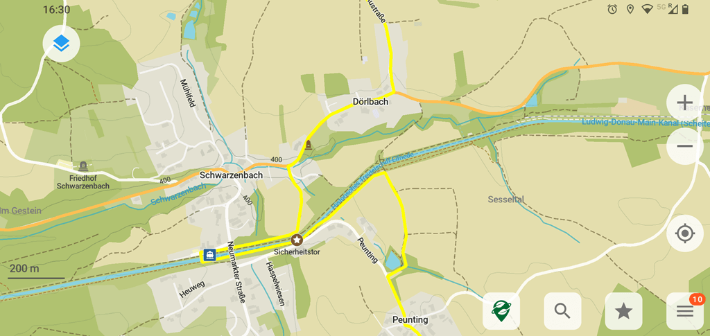
Features on the map for hikers
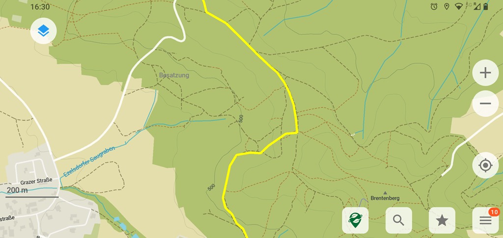
There are a few overlays for the map to choose from with Organic Maps, the most useful for hikers in my opinion is to use the height overlay on the maps, and you can even combine it with the hiking overview where all hiking tracks are highlighted on the map.
Metro overlay is more useful if you’re navigating by car or other transport since this focuses more on the streets for cars.
You can also easily search for any resources or shopping you need, and look for the nearest supermarket for resupply, water point, and much more. Navigate directly to the resource, and find your way back to trail in a moment.
Making your own tracks using Organic Maps
You can even make and share your own tracks using Organic Maps, and this is a great feature if you want to save local hikes that you make up on the spot for later. Or even to make and share hikes around your area for others to use.
That was my first introduction to and use of Organic Maps, I found a local hike that was put together by a user and hiked it. In my case, the hike combined several different existing hikes that were waymarked and connected them. So that you could walk from train station to train station.
So for anybody tired of bumping into paywalls, privacy issues, or ads when using apps for navigation, I highly recommend giving Organic Maps a try for your next hike. Let me know what your favorite navigation app is for your hikes!
Happy Hiking and Hike for Purpose!
Frank
I'm Frank, the main guy and owner of this website. Loves hiking, gear and bushcraft. And can get quite nerdy about them. In the woods several times a week preparing for my next hike. Always searching for another hill, which is quite difficult in the Netherlands. That's why I search around several countries. More about me on the about page.


You May Also Like
Anker PowerCore review | Hiking

Best Hiking subReddits to follow